Chasing Horizons in 25
A Threshold of Dreams
2025 feels like a threshold of dreams finally taking shape. For years, I've traced my fingers across maps of the Southwest, marking the elusive locations that seemed to whisper secrets just beyond reach - remote canyons, hidden petroglyph sites, and vast stretches of wilderness that exist more in geological time than human memory.
This is the year some of the bucket list destinations transform from possibilities to tangible landscapes, and I’m returning to a couple of locations that were a bust in the past. With four expeditions on the drawing board, there’s a lot of detailed planning to do. That’s part of the fun.
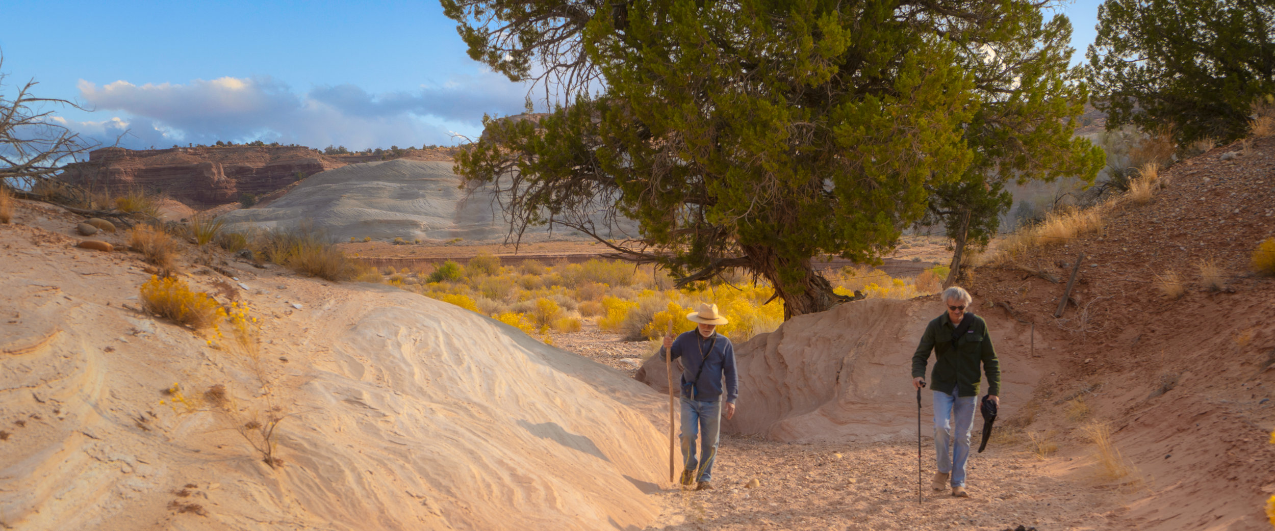
I couldn't imagine a better companion for this journey than Clyde, my longtime explorer friend whose understanding of these landscapes runs as deep as the geological strata we'll be traversing. Thirty years of wandering have etched the Southwest into his bones, into his very understanding of wilderness. He understands this terrain in a way few people can.
Food, water, gasoline and communications, are the critical components for the more remote locations. Between the two of us, we’ve got plenty of gadgetry to charge batteries, run heaters in out tents at night, lasso errant cattle, and cook full meals. Clyde seems to enjoy washing up and can light a fire with damp wood, which is a major bonus.
His truck isn't just a vehicle; it's a mobile sanctuary of survival wisdom, packed with gear that transforms potential challenges into mere footnotes. He brings his banjo, I bring my guitar, and we’ll usually have a soulful jam under the stars after dinner. These are special moments, where two “old” men spin yarns, have a swig of rum and make plans for the next day’s adventure.
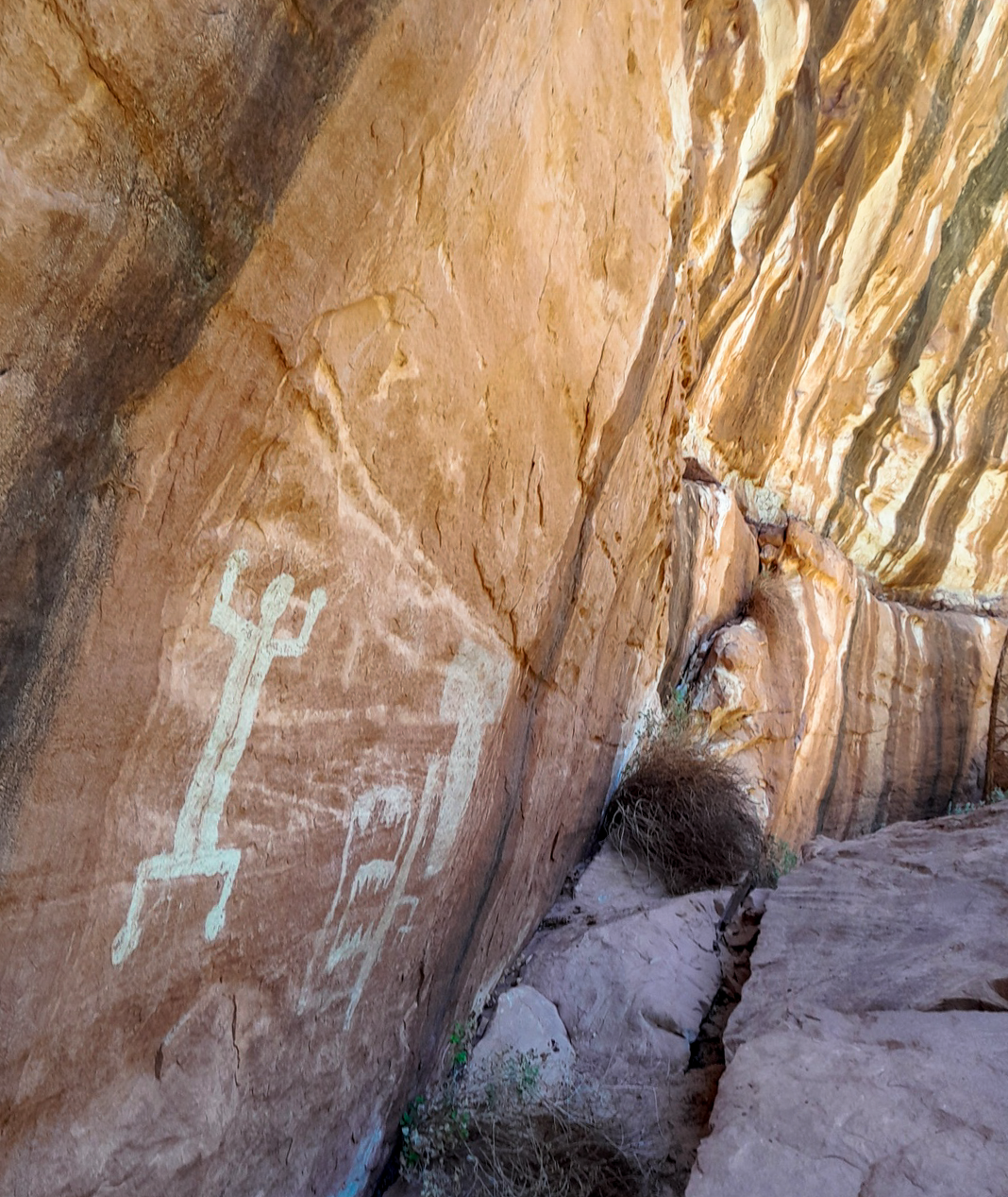
My archaeological contact in Sedona has also been hugely instrumental in planning, providing updated maps that challenge decades of historical assumptions. Those forgotten trails, those half-remembered routes. We're not just traveling with them, I’ll be recording them photographically. Each petroglyphs panel is a dialogue across centuries, a visual conversation with people whose stories have been written in stone - the Moki steps a treasured reminder of where man once dared to climb.

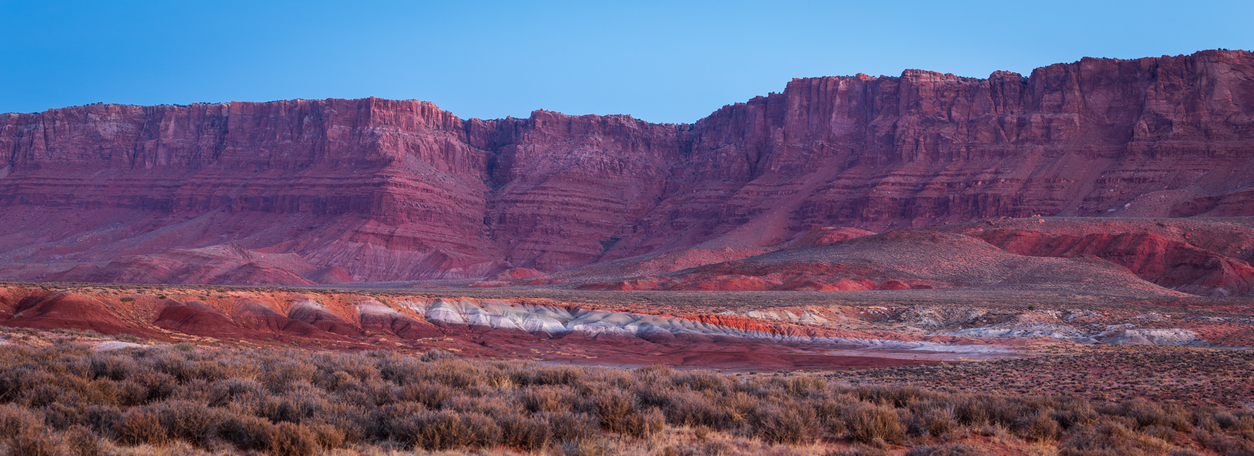
Vermillion Cliffs
I’ve driven past the cliffs many times, but have only stayed here once before, on my way north. It was just an overnight stop, and I barely had any time to explore. It will be a treat to spend a 4-5 days here and explore the plateau above.
The cliffs are part of the stunning Colorado Plateau in northern Arizona. Their vibrant red-orange sandstone formations create a breathtaking geological canvas. These cliffs are part of the larger Grand Staircase geological formation, which represents a massive sequence of sedimentary rock layers that span eons of Earth's history.
The Vermilion Cliffs region has been home to Indigenous peoples for thousands of years, with archaeological evidence suggesting continuous human occupation dating back at least 12,000 years. Several Native American tribes have deep historical connections to this landscape, including the Pueblo, Navajo (Diné), and Southern Paiute peoples.
The rock art in this region typically reflects complex cosmological beliefs, recording important events, hunting practices, spiritual ceremonies, and interactions with the natural world. Many of these art panels are carefully positioned to capture specific light conditions during solstices or equinoxes, suggesting advanced astronomical knowledge.
From my prior trip to Vermillion Cliffs. Blisteringly hot.
Beyond its geological and cultural significance, the Vermilion Cliffs support a diverse ecosystem. The region hosts unique plant and animal species adapted to the challenging desert environment, including desert bighorn sheep, various reptile species, and specialized plant communities that have evolved to survive in this harsh yet beautiful landscape.
Reflecting on the Vermilion Cliffs allows us to appreciate the intricate connections between geological processes, human history, and natural ecosystems. This landscape is not just a static backdrop but a dynamic, living environment that tells a complex story of transformation, resilience, and beauty.

Paria
I can’t wait to get back here, too. When I last visited, my dog Rupert managed to transform himself into a mud-covered disaster by getting stuck in quicksand. As I struggled to clean him up, I used nearly every drop of our clean water. I couldn't help but laugh at the absurdity of our situation. To add insult to injury, our potable water tank in the RV I’d rented chose to spring a spectacular leak, draining the primary water supply before the first night had even passed. My emergency 15-gallon reserve - meant to be our desert lifeline - was now looking decidedly inadequate. What was supposed to be an epic exploration turned into a hasty retreat.
The Paria is a significant tributary of the Colorado River, flowing through southern Utah and northern Arizona. It’s just north of the Vermilion Cliffs, creating a continuous and interconnected geological wonderland. So, it makes sense to return here after exploring Vermillion. I’d like to catch both spots early spring this time around. It will be very cold at night, but the Paria will be running, and there will be some vibrance in the shrubbery and trees.
The river itself has been a powerful geological sculptor. Its waters have exposed intricate stratification, revealing bands of color that range from deep reds to pale whites and soft yellows - a geological timeline painted in stone.
The Paria has been home to Indigenous peoples for thousands of years, with archaeological evidence suggesting continuous human habitation dating back at least 10,000 years. Several Native American groups have historical connections to this landscape, including the Ancestral Puebloans (Anasazi), Paiute, and Navajo (Diné) peoples. Archaeological sites in the Paria River corridor reveal fascinating insights into human adaptation and survival in this challenging desert environment.

Grand Gulch
This is a location I’ve wanted to explore for a couple of decades. Protected within the Bears Ears National Monument, the Gulch serves as a living museum of human prehistoric adaptation. It provides researchers with invaluable insights into how complex societies developed and survived in one of North America's most challenging environments. Unlike Vermilion and Paria’s limited archaeological evidence, Grand Gulch emerges as a comprehensive narrative of geological process and human cultural development - a landscape where stone walls, rock art, and geological strata combine to tell a rich and nuanced story of southwestern human history.
Clyde will be guiding me through the Gulch on what promises to be an extraordinary photographic expedition. As a professional photographer, I'll have the rare opportunity to document one of the most archaeologically complex landscapes in the American Southwest. His deep familiarity with the area means we'll access sites most photographers never encounter, focusing on capturing the intricate relationship between geological formations and ancestral Puebloan archaeological sites.
Our week-long journey will take us through canyon systems that reveal layers of geological and human history. Grand Gulch provides a stunning cross-section of the Colorado Plateau's evolutionary history. By comparison, Vermilion Cliffs showcase more surface-level geological drama, while the Paria River canyon demonstrates less intricate erosional patterns.
Environmentally, Grand Gulch represents a critical ecosystem interface between the Colorado Plateau's arid landscape and its limited water resources. The canyon's microclimate supported complex human societies through careful water management, agriculture, and resource utilization.
We'll likely move between sites, capturing the changing landscape as we explore the canyon's various branches. The week will be a true immersion into the visual story of Grand Gulch - a narrative that spans millions of years of geological formation and centuries of human habitation.

White Canyon
The geological formations of White Canyon, in Utah, are also part of the broader Cedar Mesa geological formation, characterized by layered sedimentary rocks that tell a story of ancient marine environments, sand dunes, and geological transformations.
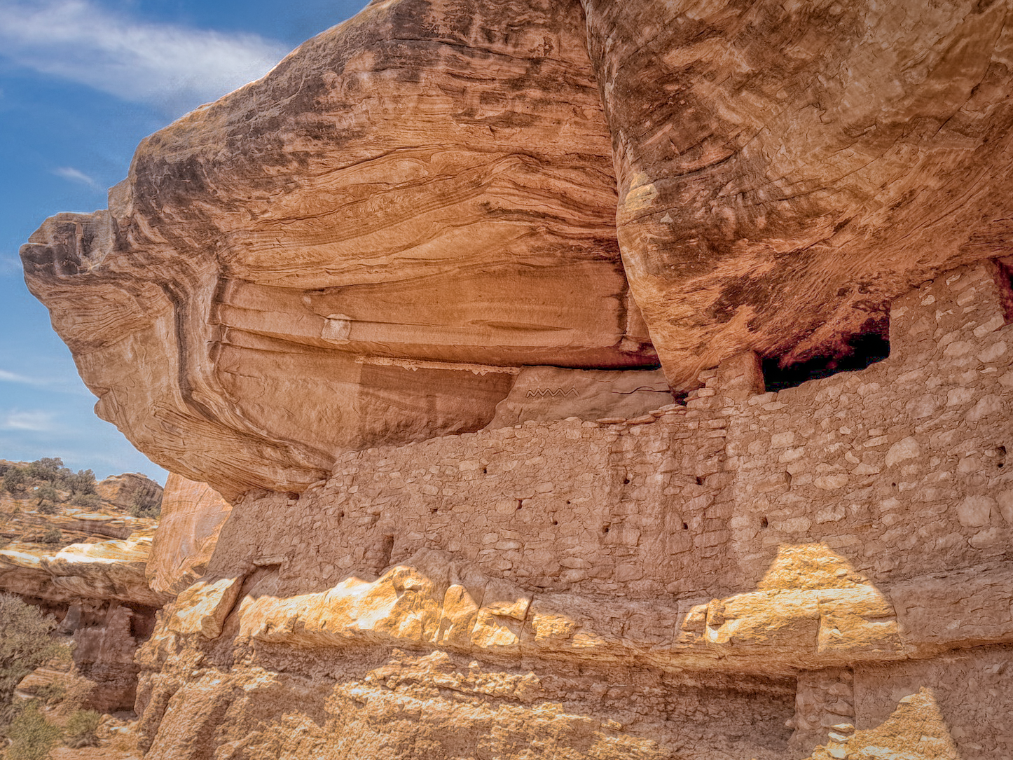
Archaeological evidence suggests that the ancestral Puebloan inhabitants of White Canyon were part of the larger cultural network that extended across the Colorado Plateau. Their settlements indicate complex social structures, advanced architectural knowledge, and a deep understanding of the local ecosystem. Rock art panels found throughout the canyon provide insights into their spiritual practices, daily life, and interaction with the surrounding landscape.
The canyon's geological structure provided natural protection and resources for these indigenous populations. Cliff alcoves offered shelter from harsh environmental conditions, while the canyon's microclimate supported limited but strategic agricultural practices. Water sources, though scarce, were critically important and carefully managed through sophisticated water collection and storage techniques.
By the late 13th century, the ancestral Puebloan communities in White Canyon had largely dispersed, likely due to a combination of environmental challenges, resource depletion, and broader cultural migrations. However, their legacy remains preserved in the archaeological sites that continue to offer researchers invaluable insights into prehistoric human adaptation.
Today, White Canyon is part of the larger Bears Ears National Monument, recognized for its exceptional archaeological and geological significance.


